VISIT TO MOUNT PLEASANT: POSTPONED
November 9, 2020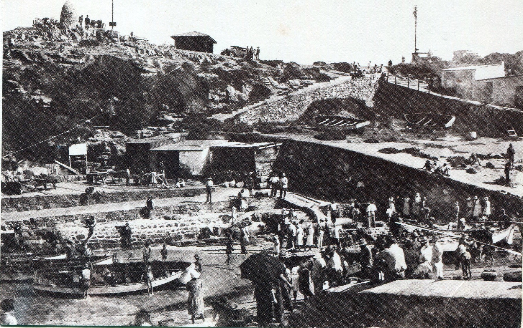
The Old Harbour -the birthplace of our town
January 13, 2021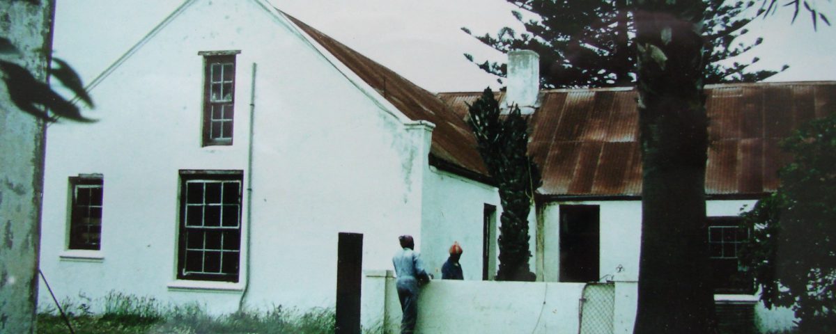
Main Road was the first road to be named in the town, followed by Harbour Road. We have photographic evidence for what both roads looked like in about 1890. The entire Main Road is shaped like a spread-out letter Z, seen from the old entrance to the town at the intersection of Main Road and Mountain Drive, straight along to the intersection with Church Street (now a traffic circle), then in a north-south direction to the junction with Harbour Road, then east-west to Lord Roberts Road, which was the original boundary of Hermanus.
The name Main Road also applies to the distance through Eastcliff to the boundary of the old Poole’s Bay area (now Eastcliff) at the Mossel River. On the other side of the river, Main Road originally became 10th Street, Mossel River, usually referred to as ‘the road to Stanford’. It was only in 1965 that a new bridge was built over the river, and today Main Road becomes 7th Street, Voélklip at the large circle. Today, we are focussing on the stretch from the circle near the Taxi Rank to the circle at the Marine Hotel.
Three problems are associated with Main Road in this area. First, it developed without any planning from a footpath to a cart track to a wagonway and to the start of the motor vehicle era. In the late 19th century no one foresaw the future growth of Hermanus or saw anything wrong with a road that made a right-angle turn in the town centre. Lack of planning also allowed residents to build dwellings and shops right up to the edge of the road itself. This practice raised many issues of demolition, expropriation, and compensation when the road was widened.
Secondly, Main Road is a Provincial road in a Municipal area, and Provincial regulations trump municipal needs. Provincial regulations apply to the width of the road, the number of entrances into the road, stop signs, traffic lights, and pedestrian crossings. Lengthy negotiations between the two parties have caused numerous delays.
Thirdly, from about the 1950s, concerned parties began to consider an alternative route, running along the foot of the mountain range to the north of the town. This has become known as the ‘bypass road’, which would carry all traffic not needing to enter Hermanus centre and going on the Stanford, Gansbaai and other towns to the east. At once, disputes grew between the authorities and environmentalists about the priorities for the town. There was one possible advantage in the bypass idea, as the Province could then ‘deproclaim’ the Main Road within the municipal boundaries and the Municipality could design it to the needs of the resident population only. On the other hand, the Fernkloof Nature Reserve would be negatively affected.
In the beginning, surveyed sites were sold by the Municipality without zoning. Houses, shops, houses-and-shops sprang up. Most of the sites with a frontage on Main Road were long and relatively thin, giving access to High Street as well. For instance, the well-known Allen family built their house facing onto Main Road (where Hermanus Property Sales is now), with another structure behind it, facing onto High Street, where Rossi’s is now. Employees of the Adelphi Cinema, which was next door to the Allen’s house who owned and managed it, were housed there.
Disputes about Main Road will continue into 2020 and beyond.
Main Road 1905: looking towards the Marine Hotel.
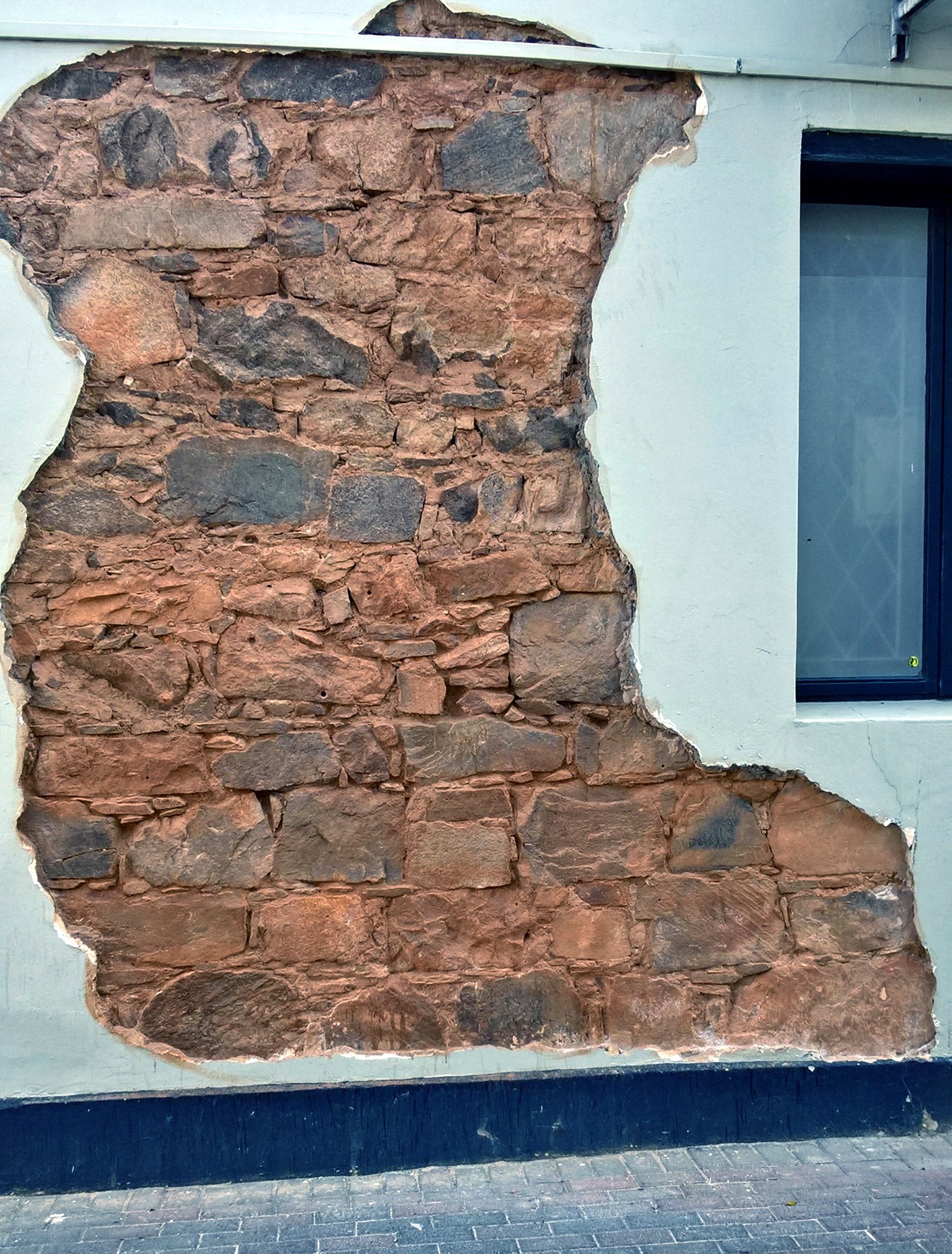
2015:deliberate exposure of basic construction of the type used in the early 20th century. Many houses in Main Road would have had walls of this kind.
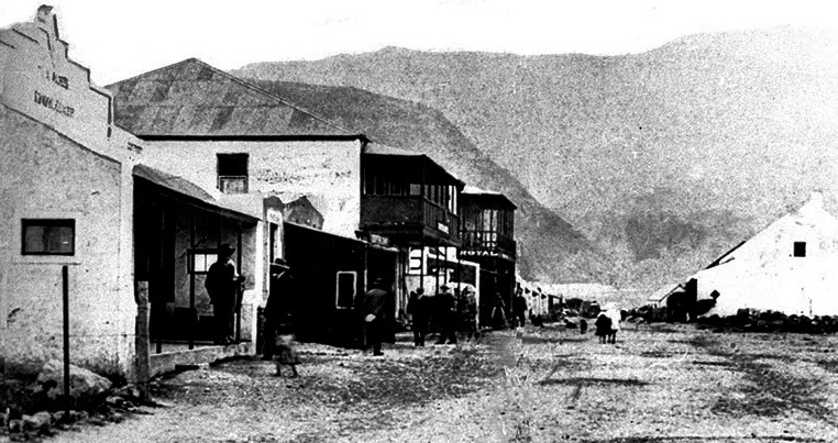
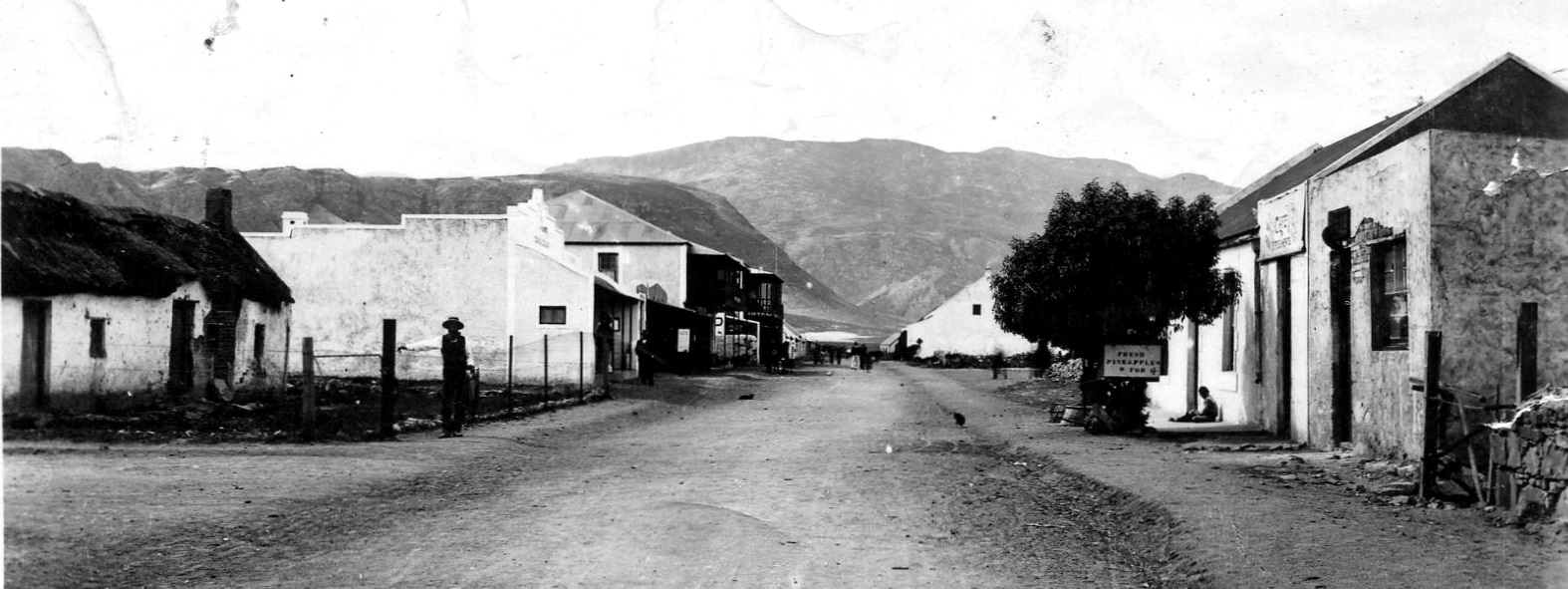
The 1890s: looking along Main Street towards the Marine Hotel
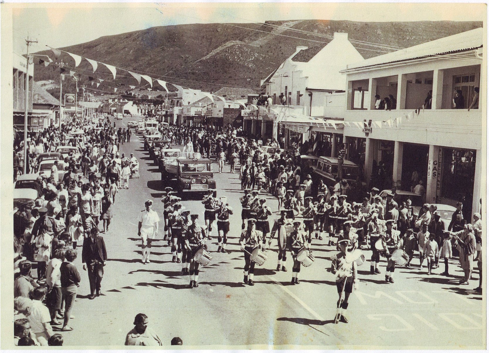
1968" Spring Fair hed annually, Hermanus High School Band, Magistrate's Court in background
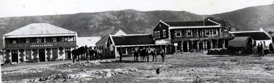
1905:Looking across Market Square towards, which runs right in front of the two hotels
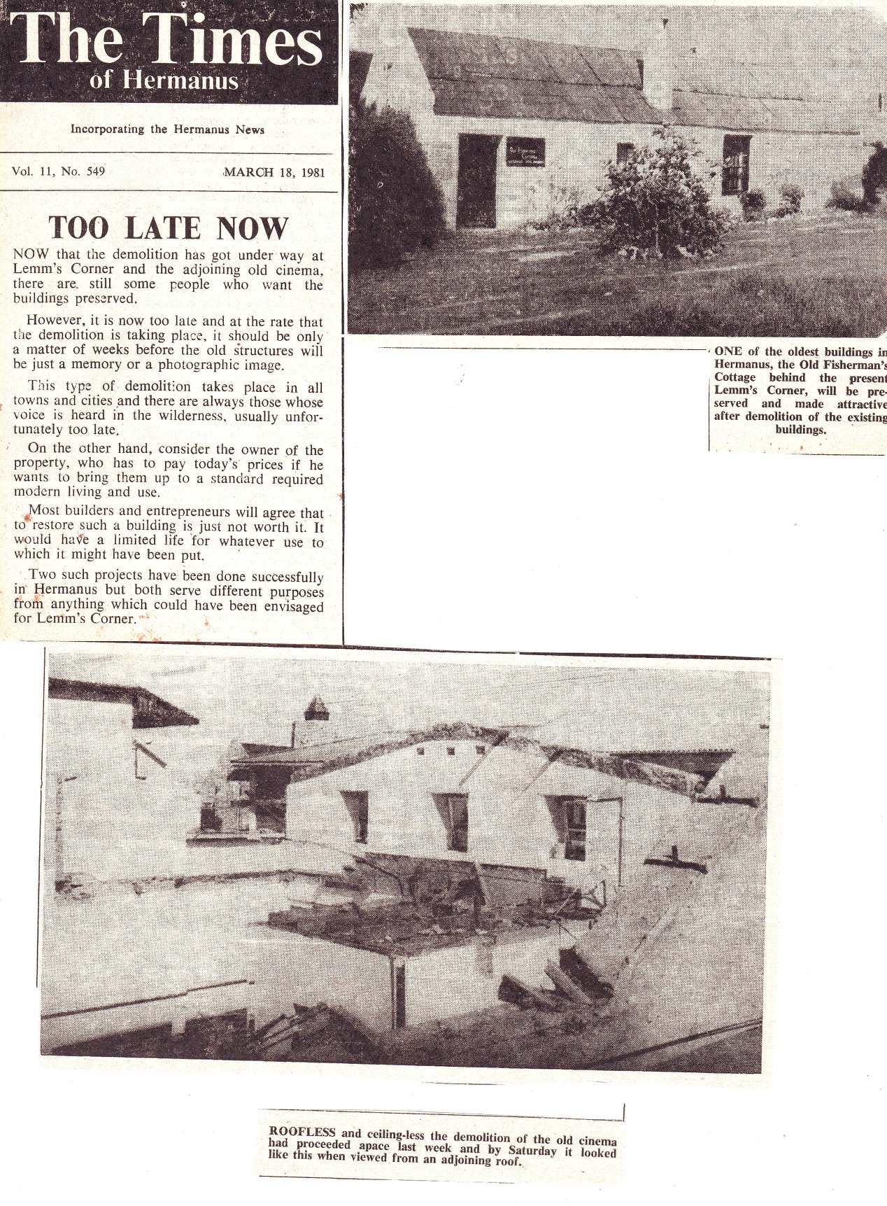
1980: press cutting of demolition of Lemm's Corner building, corner Main and Harbour (lower image). The upper picture is the original Fisherman's Cottage, saved from demolition, now a restaurant
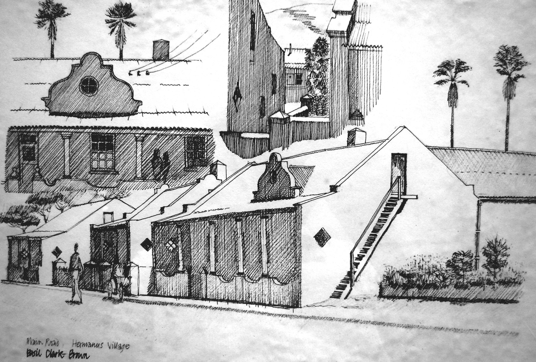
1970s: a sketch of the frontage of the Shaw house, with Main Road in the foreground. Details of the exterior given in three detailed sketches. The house was renovated at this time.
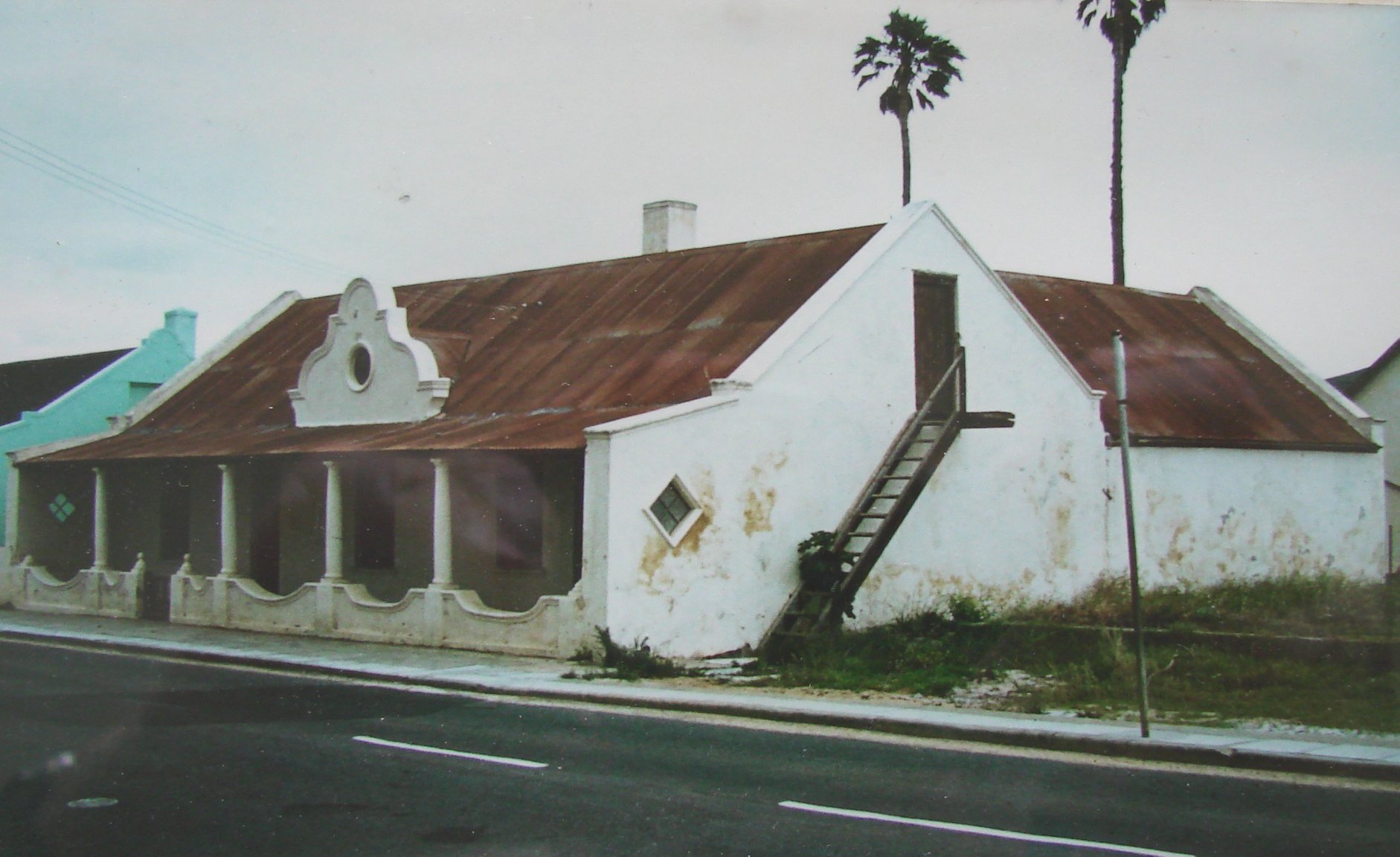
1960: theShaw house in bad condition, just prior to renovation. Note the low wall in front, the elaborate gable, the outside stairway to the upper floor. The roof would originally been thatched. A clear obstacle to road-widening!
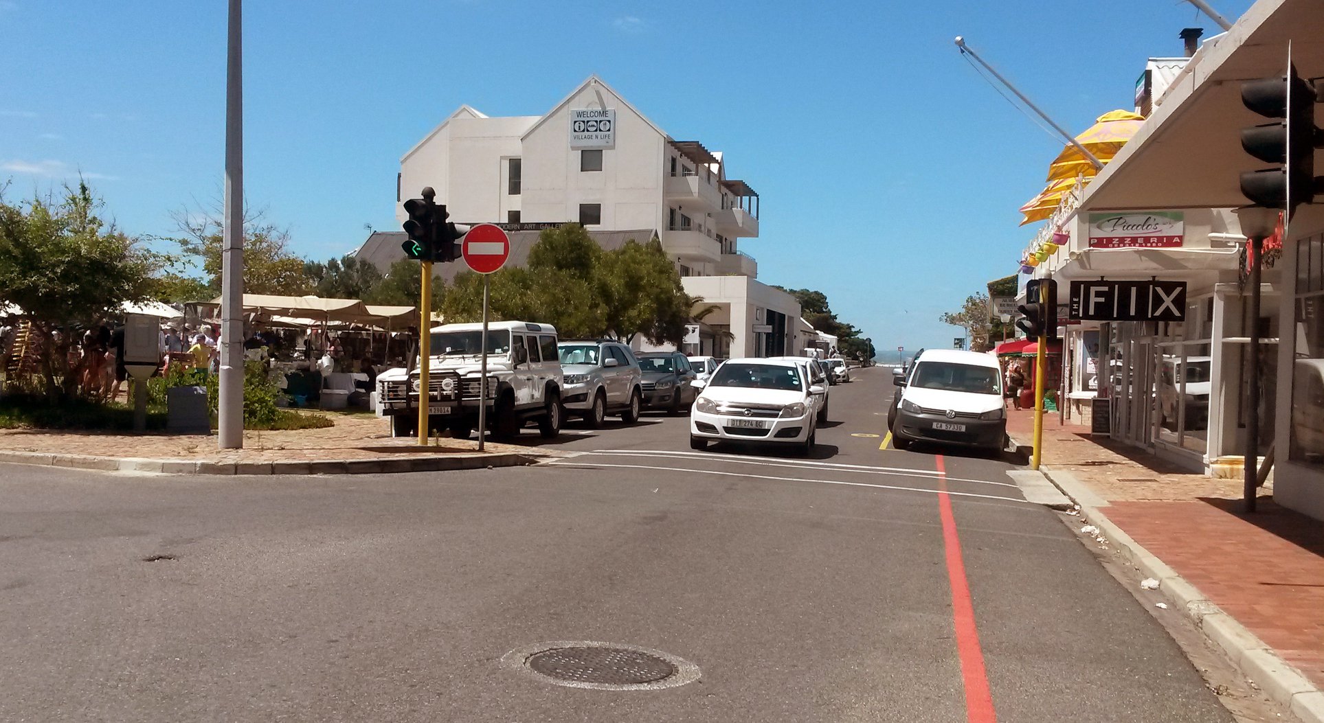
2017: corner Main and Harbour Roads. Note market on open space at Lemm's Corner. In the foreground, right, the Balcony Building, now known as the Factory Shop. In the centre completely inappropriate Quarters Hotel, a monument to inappropriate town planning.