The day the fish ran out
February 3, 2020
Members Meeting: Monday 27 January 2020
February 10, 2020
The Village Explorer
Writer: Dr Robin Lee
The Overstrand coastline is full of caves. This is because the entire coast and even mountains now kilometres inland were under the sea for millions of years. The Table Mountain Sandstone deposits, which predominate in this area, had many weak spots, and scouring action by the sea and from rivers fl owing toward the sea, created the caves.
Then, sea levels gradually dropped and the caves were exposed. Some, such as Klipgat Cave at Die Kelders are still on the coast, but others were left considerable distances inland.
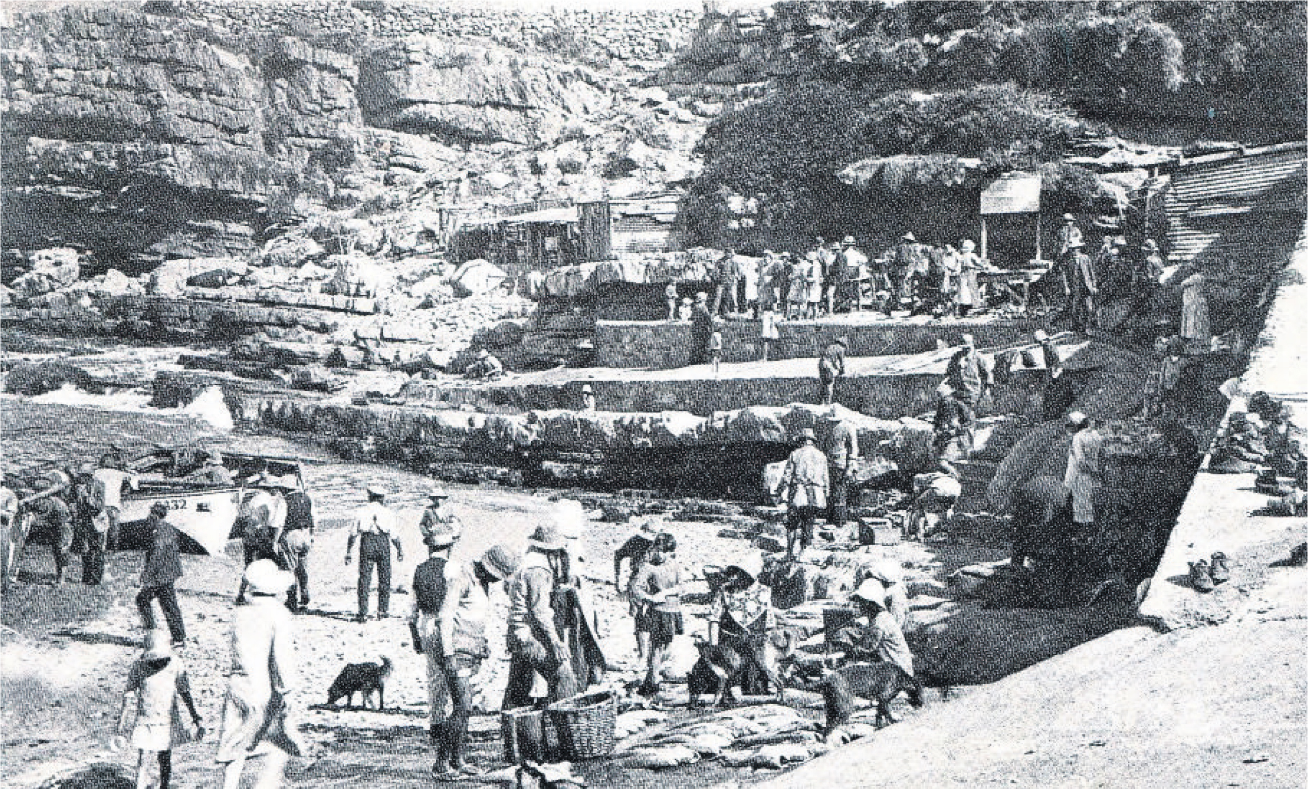
Humans used the caves for shelter during and after the Early Stone Age. Klip Kop Cave is approximately one kilometre inland, about half way up Hoy’s Koppie. You can reach it easily from the south and west sides, along the paths laid out on the koppie. Artefacts from the cave were dated from 70 000 to 100 000 years ago.
The cave was professionally excavated in 1925 and 1935, and the prominent Hermanus fi gure WH (Meester) Paterson collected many artefacts between the excavations. He turned these over to Dr AJH Goodwin, who conducted the second of the ‘digs’. The objects show that humans inhabiting the cave had a single mode of life and all remains date from the same period.
The cave-dwellers ate mainly shellfi sh, fi sh, and other marine life. Quantities of broken shells littered the floor of the cave. However, only a few are shaped for human use. Mostly, the inhabitants threw away the shells after the contents had been eaten. There were also a few animal bones, but quite a wide variety – eland, other smaller buck, tortoise shell, ostrich shell, and duiker. But the numbers found are tiny in comparison to ordinary marine remains. The leader of the first dig commented:
The small quantity of animal remains makes me wonder whether there was any scarcity of animals at this place, or were the people just too lazy to hunt?
A single human skeleton was found in the cave and seems to be an ordinary burial, as the body does not show any marks of violence.
There is little evidence of occupation of the cave by groups known to live in this area during the interglacial period we are still experiencing, and it may be that sea levels rose and covered the cave. For a time, during the last Ice Age, the fall in sea levels left Walker Bay dry and exposed to the sunlight. The sea-bed dried and sand blew inland. The cave was buried by blown sand and was in that state when European settlers first came across it.
But, around 1870 a ‘poor-white’ or coloured family cleared the cave and lived in it. They also built a wall dividing the cave into two rooms and painted the cave walls. Some remains were probably lost at this stage. After the 1935 excavation, the remains were analysed and the relevant authority decided that no purpose would be served by further work. The cave was cleaned out and eventually became part of the Fernkloof Nature Reserve.
The cave has suffered much wear and tear over time. It has recently been used by vagrants and by schoolchildren seeking to escape the supervision of parents and teachers. Vandals have painted on the walls and drinking parties were held inside. Eventually, the Municipality provided security for the cave. A barrier was built across the entrance, without obscuring any aspect of the cave. In the 2000s a motion detector was installed, with a line-of-sight link to the Municipal Law Enforcement department without alerting the invaders. The presence of the sensor appears to have had a positive eff ect. However, we have to use our imaginations to see the cave at sea level and providing our ancestors with a place of refuge and safety as long as 100 000 years ago.
Millennia after the early humans had departed, a new people appeared in the Overstrand. They were the San people, fi rst called “Bushmen” by the settlers. They seem to have moved from territory to the north, perhaps pushed out by other, more organised tribes. The San were nomadic hunter-gatherers, with minimum possessions, but they left vivid evidence of their presence through rock art, such as can be seen at Philipskop, near Stanford.
The San used the caves along the coast for occasional shelter. This is not the case with the next group of people to play a part in the prehistory of our area. These were the “Hottentots”, a word used by Europeans in an inaccurate imitation of the language the new arrivals spoke. Names for the group have changed over time, as more is learnt about them. At the moment, they are known as Khoenkoen and were a pastoralist society, with large herds of cattle that were their most valuable possession. They had probably moved south under pressure from the Bantu-speaking peoples journeying south from their origins nearer to central Africa.
The Khoenkoen settled in large numbers in the area now known as the Overstrand, with the senior chief living in a large ‘kraal’ near Caledon. Smaller kraals existed under sub-chiefs, including one near the Bot River. The name of the river is said to refer to a place of contact of Europeans with the Khoenkoen, where the whites bartered small implements and jewellery for butter (botter in Dutch, shortened to Bot). In the 17th century, this clan was headed by a chief named Klaas by the Dutch. His people played a role in the rescue of several ship-wrecked parties trying to reach the Cape.
There was intermittent fighting between the San and Khoenkoen, and also between the latter and white Trekboers. After confl icts like this, men and women of the San and Khoenkoen sought shelter with white settlers. Over time, they drifted into a form of indentured worker status.
A decisive event occurred in 1713, when an epidemic of smallpox resulted in the deaths of large numbers of the Khoenkoen, and the clan structure of their society broke down. Survivors drifted into the service of whites. We cannot over-estimate the importance of the epidemic. It depopulated the land that would become the Overberg and ended any armed resistance to Trekboers being granted farms in the area. Among these was the farm Mosselrivier on which a settlement called Hermanuspietersfontein would be established in the next century.
The birth of our town was peaceful and tensions between what would come to be called ‘races’ was never experienced.
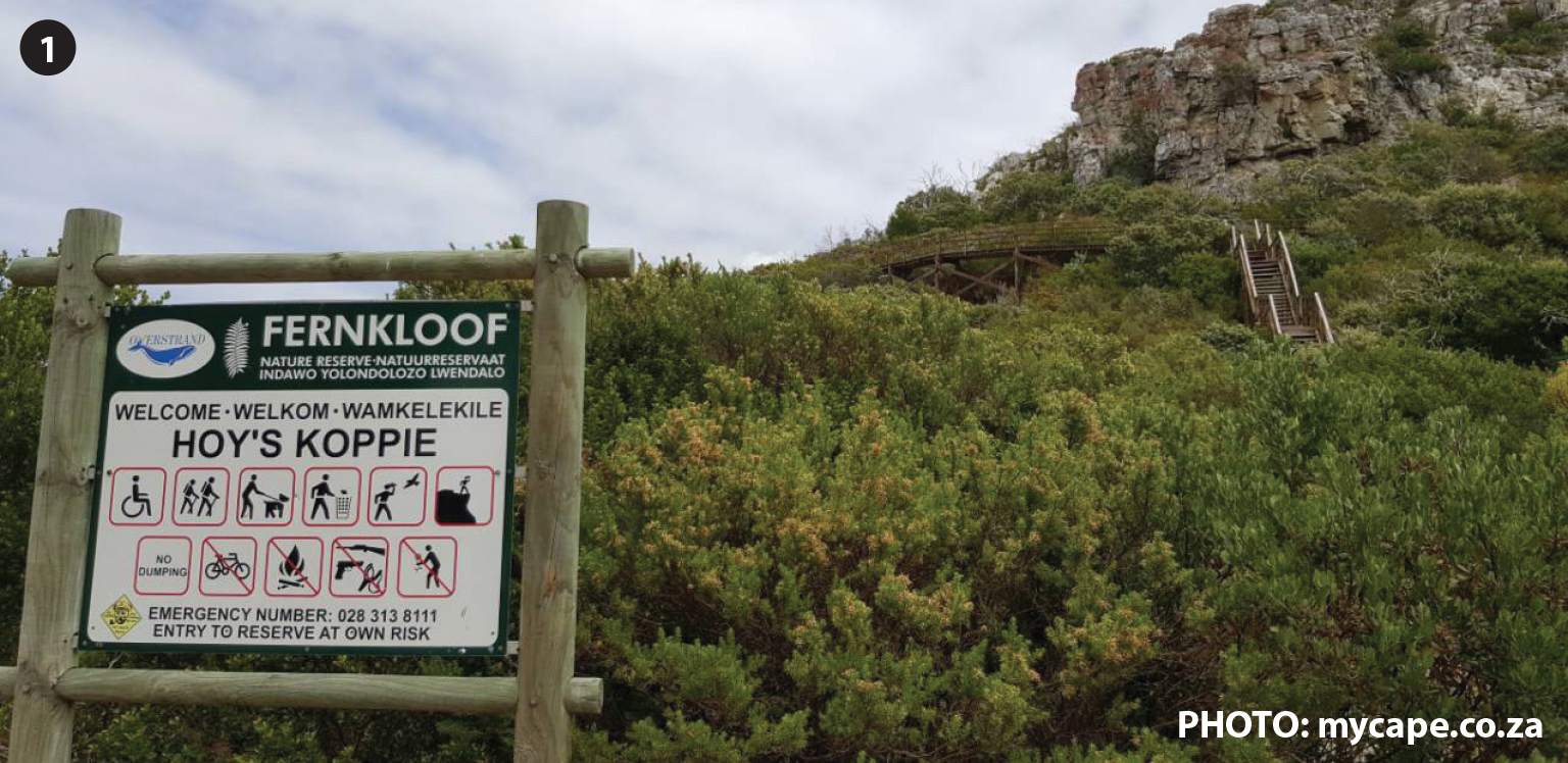
Hoy’s Koppie forms part of the Fernkloof Nature Reserve and can be reached by way of paths laid out on both the south and west sides.
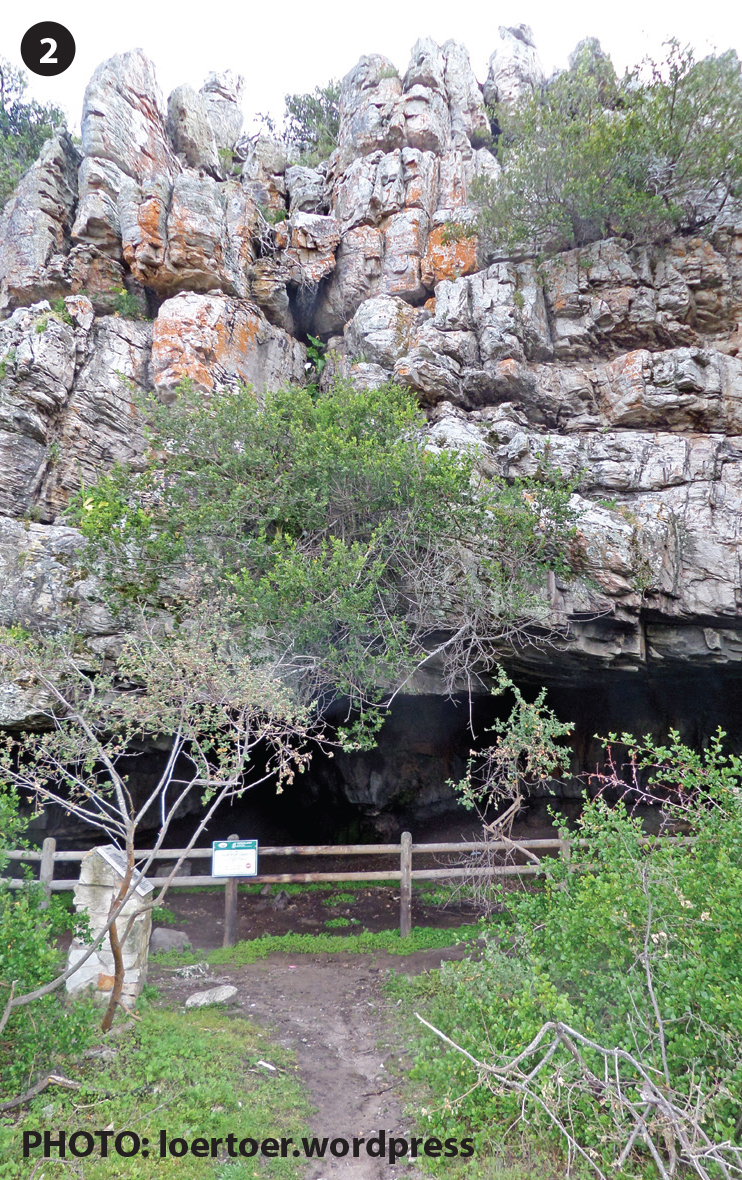
Klip Kop Cave on Hoy’s Koppie provided shelter to humans as far back as 100 000 years ago.
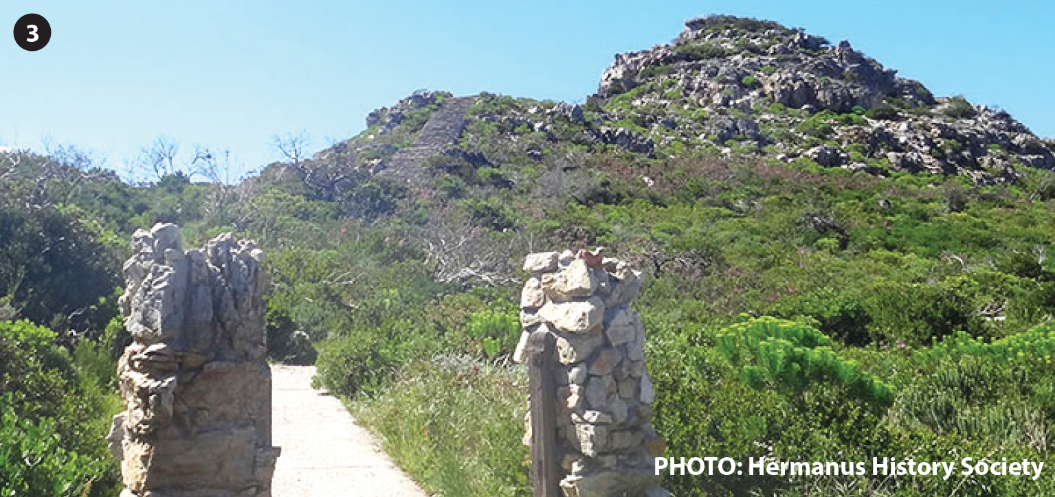
The entrance to Hoy’s Koppie from Magnolia Street.
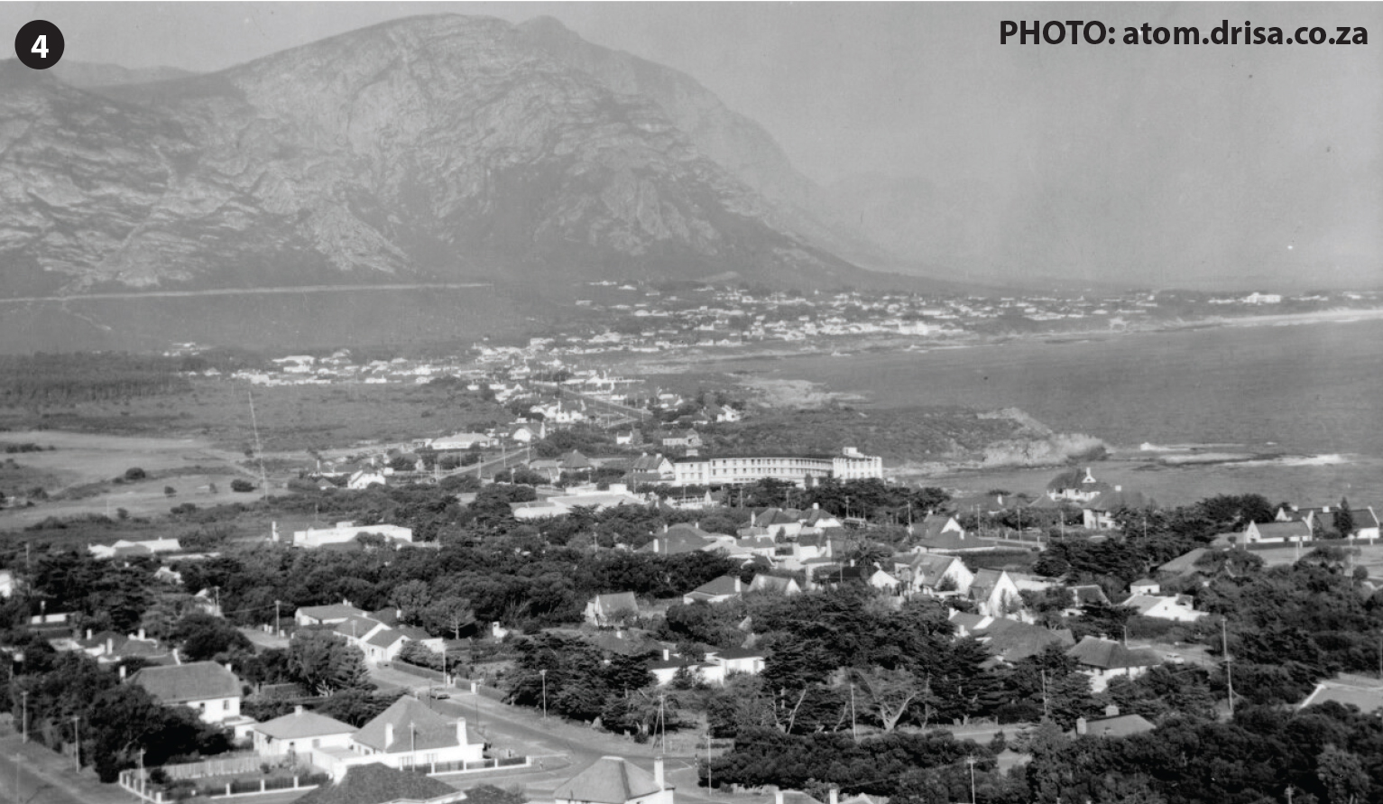
An old photograph of Hermanus taken from Hoy’s Koppie, next a more recent one.
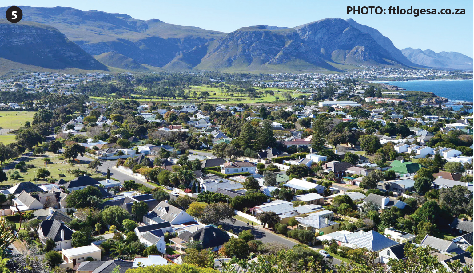
An old photograph of Hermanus taken from Hoy’s Koppie, next a more recent one.